The waterRIDE suite.
The waterRIDE suite contains a number of different modules which are included based on your individual requirements. Get in touch to discuss your options.
Some are designed to work together, while others are available as standalone tools.
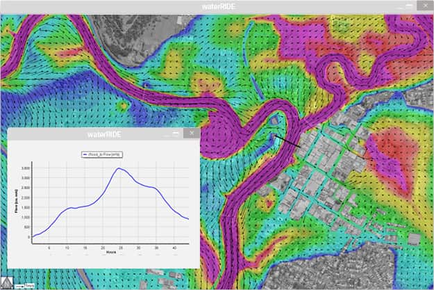
FLOOD Manager
FLOOD Manager is the hugely powerful, central module of the waterRIDE suite. It is a purpose-built floodplain management support system designed to allow anyone to easily and quickly access flood information. Based on the waterRIDE time-varying GIS environment, it supports the results of any 1D or 2D flood model.
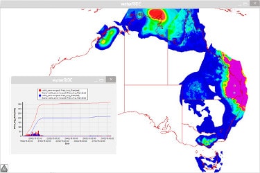
Forecast Console
The Forecast Console automates the data collection and processing in a waterRIDE-based real-time flood forecasting system. It makes it even easier to determine what impending flooding may mean to you.
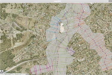
1D Surface
1D Surface allows you to build a 2D framework for your 1D model results. This can then be used with the FLOOD Manager module to query a range of flood information as if it were a native 2D model.
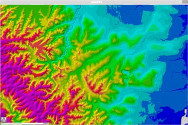
TERRAIN
TERRAIN was developed to create usable digital elevation models from massive airborne laser scanning or LiDAR terrain datasets, on demand. The module employs advanced data scaling algorithms to ensure you receive the highest quality DEM possible from your raw data.

visionMAKER
visionMAKER helps you to create an effective knowledge interface containing live GIS data linked to just about any external data formats. From documents to webpages, to videos and photos, visionMAKER is able to bring together information in a user friendly interface to help you tell your spatial story.
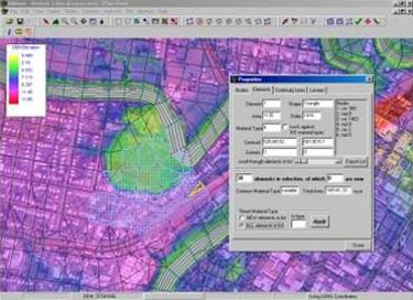
RMAnet
RMAnet is a tool designed primarily to assist modellers in generating finite element networks for the RMA suite of models.
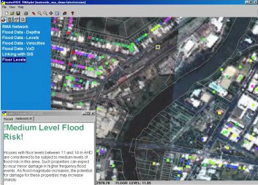
RMAviewer
RMAviewer was designed specifically to bridge the communication gap between modellers and non-modelling decision makers by greatly enhancing the visual appreciation and understanding of RMA hydraulic and water quality model results.