“I need to prepare and present flood modeling results, quickly and easily.”
Quality presentations
Impress your clients by presenting high quality, interactive modeling results with minimal effort.
Rapid deliverables
Rapidly prepare deliverables with dedicated tools.
Data management
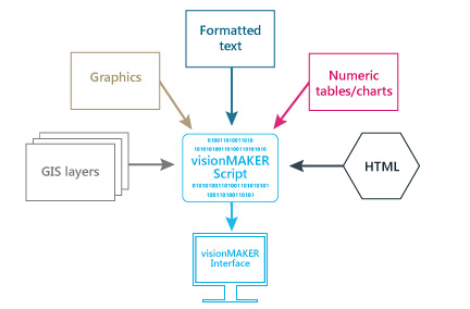
Model results, GIS layers, reports, spreadsheets, site photos, and much more can be readily accessible.
Pack ‘n’ go
Collect all necessary files in your project and copy them to a single location for easy delivery to clients.
waterRIDE makes it easy for a consultant to process, present, and deliver flood modeling results to clients, in a format that they can utilize.
waterRIDE provides consultants with feature-rich, purpose-built tools for enhancing the efficiency of preparation and presentation of hydraulic modeling deliverables, from any hydraulic model.
The waterRIDE environment was developed by engineers at Advisian who themselves are active in the hydraulic, hydrologic, floodplain and flood emergency management industries. The system has been designed with workflow in mind, streamlining many of the tedious processes involved in preparing high quality deliverables for clients.
Models currently supported include (both 1D and 2D): TUFLOW, TUFLOW FV, MIKE11/21/FLOOD/SHE/URBAN, RMA2, RMA10, RMA11, InfoWorks, ISIS, SOBEK, DELFT 3D, FLS, SELFE, RiverFlow 2D, time-varying ASCII grid output, HEC-RAS, XP-STORM, EXTRAN (XP-SWMM), DRAINS overland flow, ESTRY, ANUGA, ICPR, and even hard copy results.
More Benefits
- Client data management system
Assist your client in managing their flood modeling datasets by developing a flood data management system using waterRIDE. - Time-varying GIS analysis
The unique integration of time varying datasets with GIS allows rapid time-based analysis for use areas such as: evacuation planning/phasing, interactive animations, hazards identification determination of true peak values, and integration with clients property datasets. Such processes can be quite cumbersome in conventional GIS. - Task-oriented tools
Tools are designed to get a job done faster, such as the flood damages tool. It automatically integrates your water surfaces with floor levels, property types and damage curves to calculate damages across a range of flood events (to automatically calculate AAD and carry out a net present value analysis), or across results for different flood mitigation options to carry out a comparative cost-benefit analysis. - Quality assurance
The highly visual nature and powerful toolsets of waterRIDE provide a rapid means of identifying modeling errors, understanding model (and natural) behavior, verifying and calibrating models, and providing consistent, high quality deliverables. - Evolving products
waterRIDE products are under constant development, reflecting the changing needs of the industry and our users. - Flood forecasting and flood data management systems
Readily develop systems for your client, enhancing the level of services offered.